
|
Homepage seismic haz |
| Preparedness |
| Earthquakes |
| Faults |
| Shaking |
| Buildings |
| Losses |
| More info |
|
Homepage for EPS 20 |
| Richard Allen |
| Seismo Lab |
| Earth & Planetary |
| UC Berkeley |
|
Faults
The USGS map of recent earthquakes also shows active faults across California and Nevada. Click on a region of the state to zoom in, then roll your mouse over the faults (or earthquakes) to find out more information. The CGS maintains an interactive fault map for California. Click on a fault to get its name, length and slip rate. SCEDC maintains a database of faults in southern Califonrnia. Click on a fault to get more information about it. Alquist-Priolo Earthquake Fault Zones The Alquist-Priolo Earthquake Fault Zoning Act was passed in 1972 to mitigate the hazard of surface faulting to structures for human occupancy. This state law was a direct result of the 1971 San Fernando Earthquake, which was associated with extensive surface fault ruptures that damaged numerous homes, commercial buildings, and other structures. The intent is to prevent building of new structures (for human occupancy) on the trace of surface faults.
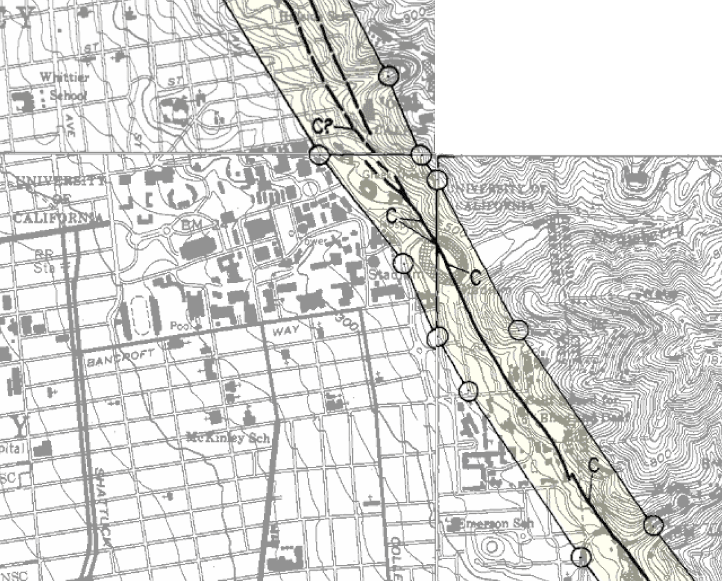
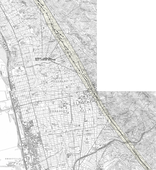
More maps: Earthquake Fault Zones are defined as the region within 50 feet of active faults. Active faults are those that have shown displacement during the last 11,000 years. One of these zones runs across the UC Berkeley campus (above). Maps of other fault zones aross the state are available from the CGS website on the Alquist-Priolo Earthquake Fault Zones. The maps are also available on the UC Berkeley Earth Sciences and Map Library Web page but require UC access. |
 Fault maps